

Welcome!
Log In
DDS Files
Posted by Razvan Cash Soranescu
|
DDS Files October 20, 2012 04:16AM |
Registered: 11 years ago Posts: 3 |
Hello,
I was wondering what are you using to modify the DDS files in the maps folder.
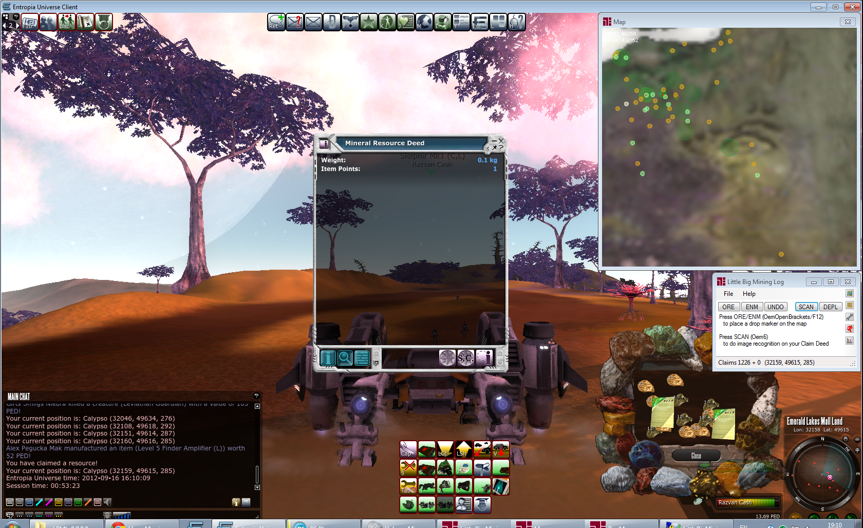
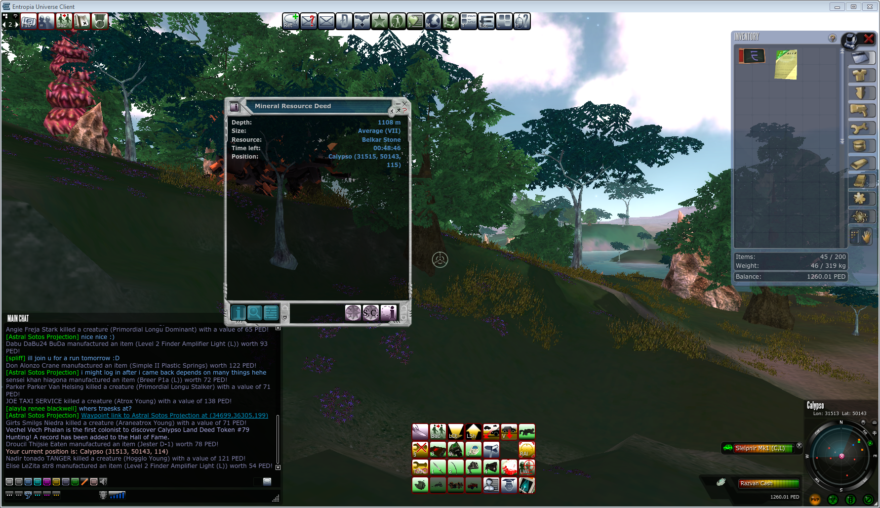
The reason i am asking is because MA modified the format of the claim deed: the height of the find, on the POSITION line, next to the planet, longitude and latitude is lower on the line - as seen in the pictures.
I was wondering what are you using to modify the DDS files in the maps folder.
The reason i am asking is because MA modified the format of the claim deed: the height of the find, on the POSITION line, next to the planet, longitude and latitude is lower on the line - as seen in the pictures.
|
Re: DDS Files October 22, 2012 03:53PM |
Registered: 11 years ago Posts: 1 |
|
October 25, 2012 08:09AM |
Admin Registered: 11 years ago Posts: 972 |
The DDS files contain the graphics for the claim markers player marker etc .. changing those will not solve the issue.. but you can mod the way your LBML presents the data ;D
MA changes the way the text of the claim deed is laid out so i need to modify program image interpreting logic to solve the issue..
Actually i solve that already but to make a release i still need to close some outstanding issues with client server synchronization because i changed a hell lot of thing in the LBML : )
Best Regards
Ido Sunrider